


City Guide
City Guide
A city-life platform that integrates all aspects of urban life, citizens, tradespeople, commerce, industry, tourism, and culture, together with municipal services
OverviewExplore
How the City Guide Works
A city-life platform that integrates all aspects of urban life, citizens, tradespeople, commerce, industry, tourism, and culture, together with municipal services
City GuideCity Life Platform
Overview
Manage Your Processes on a Single Platform with the City Guide
The City Guide is a map-based city guide system that gathers all of municipalities’ location-based information about city life on a single platform and makes it available to citizens. With functions such as category-based filtering, icon-supported map display, detail information cards, and proximity search by location, the system brings city-life data together on a single screen.
★
City Guide
360°
delivers end-to-end digital process management
The City Guide is a map-based city guide system that gathers all of municipalities’ location-based information about city life on a single platform and makes it available to citizens. With functions such as category-based filtering, icon-supported map display, detail information cards, and proximity search by location, the system brings city-life data together on a single screen.
◆HIGHLIGHTS
Map
It enables all important points in the city (public institutions, healthcare, education, cultural areas, etc.) to be displayed on the map.
It enables all important points in the city (public institutions, healthcare, education, cultural areas, etc.) to be displayed by category on a geographic map. Layer-based filtering and location-based search can be performed.
0172%
0284%
Format Support
It supports SHP, KML, KMZ, GML, GeoJSON, WFS/WMS, and SQL-based data formats.
It offers bulk data upload (Excel/CSV). Corporate data sources are standardized within the same city guide structure.
0178%
0288%
Detailed Reports
Category-based content lists and visit and access analyses can be obtained through the system.
Publication status reports and city content performance indicators provide decision-support data for institutional teams.
0184%
0292%
Capabilities
The City Guide Management Process
Managed from Start to Finish
- 01.Where and How City Life HappensAnswers to where, how, and when questions in the city’s art, culture, literature, event, and social solidarity areas are presented, along with information on how to participate and what can be gained.
- 02.Quick Access and Location NavigationUsers can directly access the relevant location on the map by selecting among cities, important buildings, tourist areas, and special points.
- 03.ServicesIt provides access to, benefit from, and information about the services carried out by the municipality, in plain language and with public reach.
- 04.Personalized CityIt supports welcoming, profiling, guiding, and responding processes with content tailored to each family, individual, and tradesperson.
- 05.TourismArchaeology, nature, attractions, history, and architectural values are promoted on a single city-life platform.
- 06.City Content ManagementCity data on institutions, service points, tourist areas, and social amenities is managed by category and presented to citizens in a standardized and controlled manner.
- 07.Tradesperson-CommerceIt is managed with information on business records, featured businesses, services provided, products sold, why they are valuable, and why they should be preferred.
- 08.GastronomyWhat to eat where, food stories, favorites, and preferences are presented as part of the city-life experience.
Core Capabilities
Modules that support City Guide operations
The core capabilities are organized as corporate modules in line with the product flow.
Go to OverviewMap-Based City Guide View
Important points across the city, tourist areas, public services, and social amenities are displayed on an interactive map.
Quick Access and Location Navigation
Users can directly access the relevant location on the map by selecting among cities, important buildings, tourist areas, and special points.
Map-Based Location Operations
Operations such as copying coordinates, getting directions, parcel queries, and viewing weather and prayer-time information for points selected on the map are carried out from a single screen.
Layer Management and Map Infrastructure
Users can switch between different base maps and thematic layers. With layer visibility and transparency controls, a personalized analysis environment is created.
Map Drawing and Area Analysis
Users can mark specific regions by drawing areas, boundaries, and polygons on the map and perform measurement operations.
City Content Management
City data on institutions, service points, tourist areas, and social amenities is managed by category and presented to citizens in a standardized and controlled manner.
Capability Cards
Everything City Guide Management Requires,
in a Single Platform
The main modules are organized as concise corporate summary cards.
City Map
Map-Based City Guide View
Important points across the city, tourist areas, public services, and social amenities are displayed on an interactive map.
Quick Access
Quick Access and Location Navigation
Users can directly access the relevant location on the map by selecting among cities, important buildings, tourist areas, and special points.
Map Location
Map-Based Location Operations
Operations such as copying coordinates, getting directions, parcel queries, and viewing weather and prayer-time information for points selected on the map are carried out from a single screen.
Map Layers
Layer Management and Map Infrastructure
Users can switch between different base maps and thematic layers. With layer visibility and transparency controls, a personalized analysis environment is created.
Map Drawing
Map Drawing and Area Analysis
Users can mark specific regions by drawing areas, boundaries, and polygons on the map and perform measurement operations.
City Content
City Content Management
City data on institutions, service points, tourist areas, and social amenities is managed by category and presented to citizens in a standardized and controlled manner.
Detailed Reports
Detailed Reports
Category-based content lists, visit and access analyses, and publication status reports can be obtained through the system.
Integration Compatibility
Integration Compatibility
It provides an infrastructure for integrated operation with municipal information systems, open data services, and map-based data sources.
Resources
Explore our promotional materials
You can access presentation and promotional content about the City Guide from this section.
Product Tour
Explore City Guide
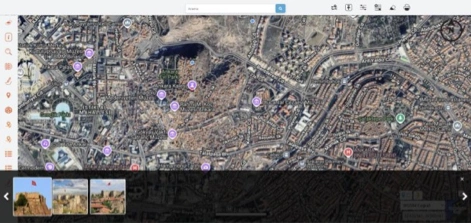
Map-Based City Guide View
Important points across the city, tourist areas, public services, and social amenities are displayed on an interactive map.
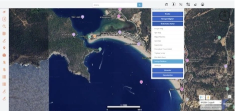
Quick Access and Location Navigation
Users can directly access the relevant location on the map by selecting among cities, important buildings, tourist areas, and special points. This structure enables guide-quality data to be displayed quickly.
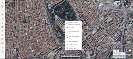
Map-Based Location Operations
Operations such as copying coordinates, getting directions, parcel queries, and viewing weather and prayer-time information for points selected on the map are carried out from a single screen.
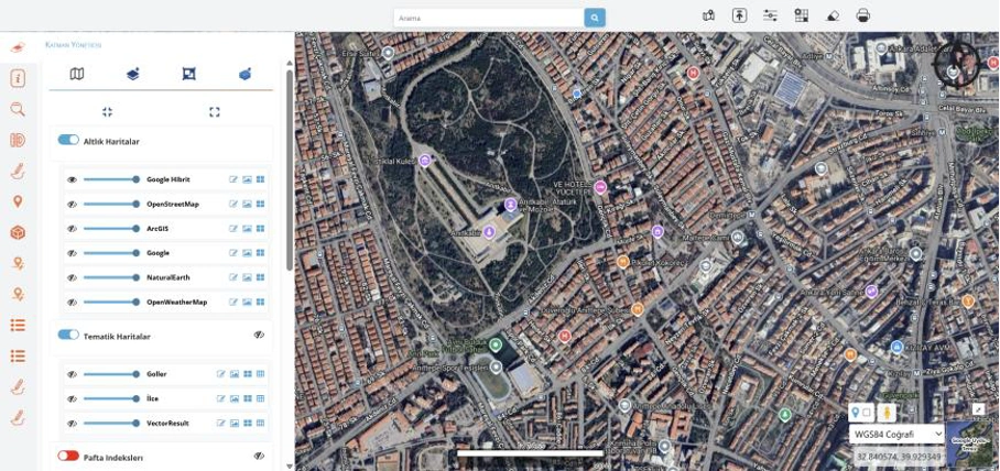
Layer Management and Map Infrastructure
Users can switch between different base maps and thematic layers. With layer visibility and transparency controls, a personalized analysis environment is created.
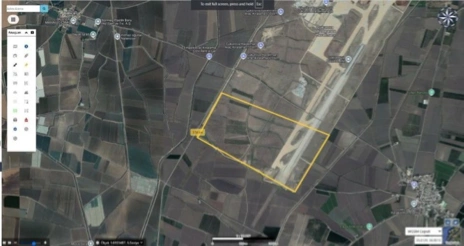
Map Drawing and Area Analysis
Users can mark specific regions by drawing areas, boundaries, and polygons on the map and perform measurement operations.
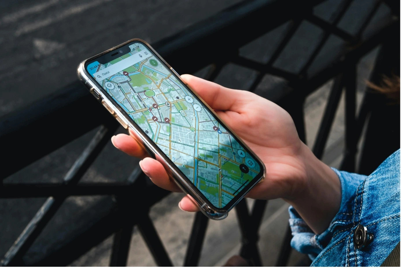
City Content Management
City data on institutions, service points, tourist areas, and social amenities is managed by category and presented to citizens in a standardized and controlled manner.
FAQ
Quick answers about the City Guide
The core use cases and corporate value of the product are summarized here.
Contact UsThe City Guide is a map-based city guide system that gathers all of municipalities’ location-based information about city life on a single platform and makes it available to citizens. The system works with category-based filtering, icon-supported map display, and detail information cards.
It enables all important points in the city (public institutions, healthcare, education, cultural areas, etc.) to be displayed by category on a geographic map. Layer-based filtering and location-based search can be performed.
Category-based content lists, visit and access analyses, and publication status reports can be obtained through the system.
It can work integrated with Spatial Address Registration System, Land Registry and Cadastre Information System, municipal information systems, SMS/email services, and open data services.
It provides data management in compliance with the Personal Data Protection Law No. 6698, Municipality Law No. 5393, and e-Municipality standards.
It offers a city-life platform that enables the integration of all aspects of urban life, citizens, tradespeople, commerce, industry, tourism, and culture, together with municipal services.
City Guide
Digitize Your Processes,
Increase Control
The City Guide is a map-based city guide system that gathers all of municipalities’ location-based information about city life on a single platform and makes it available to citizens. With functions such as category-based filtering, icon-supported map display, detail information cards, and proximity search by location, the system brings city-life data together on a single screen.
Map
Format Support
Detailed Reports
Integration Compatibility